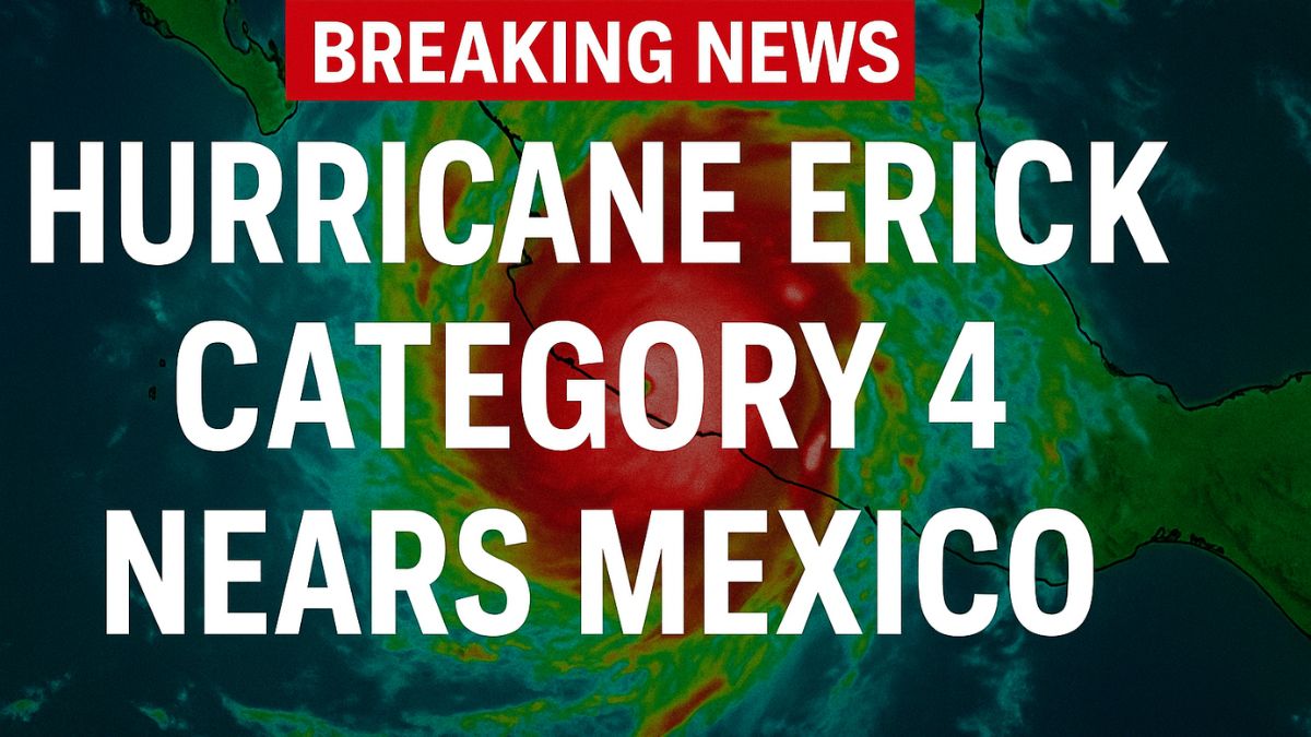
New York: Just days after forming in the eastern Pacific, Hurricane Erick has gone from an unassuming tropical storm to a full-blown Category 4 monster. With sustained winds topping 145 mph, it’s one of the strongest early-season hurricanes in recent memory—and it’s headed straight for Mexico’s southern coast.
For residents in Oaxaca, Guerrero, and nearby regions, the sense of urgency is growing. Communities are boarding up windows, schools are closed, and evacuation orders are in place. The fear isn’t just about wind—it’s about flash floods, mudslides, and the trauma of past storms that still lingers in memory.
What makes Erick especially dangerous is how fast it intensified. NOAA experts have flagged this storm as a textbook case of rapid intensification—a worrying trend that climate scientists say is becoming more common as ocean temperatures rise. Here’s what you need to know, what areas are at highest risk, and how this storm fits into a broader climate pattern.
Also Read: Tropical Storm Erick Could Hit Mexico Hard — What You Need to Know Now
Erick’s Path: Where the Hurricane Is Headed
The National Hurricane Center (NHC) has issued warnings for large portions of Mexico’s southern Pacific coast. According to the latest NOAA projections, Hurricane Erick is expected to make landfall between Acapulco and Puerto Ángel, with the storm’s outer bands already delivering intense rain and wind to coastal towns.
As of June 19, Erick’s central pressure has dropped significantly—an indicator of strengthening—and radar imagery shows a tight, well-formed eye. The projected cone includes several tourist hubs and fishing villages along the coast, making local evacuation efforts both urgent and complex.
Key at-risk zones:
- Acapulco
- Puerto Escondido
- Huatulco
- Puerto Ángel
- Coastal Oaxaca and Guerrero
Why Hurricane Erick 2025 Is a Big Deal
Erick isn’t just another storm. It’s the earliest fifth named storm (“E” storm) ever recorded in the eastern Pacific, and it achieved major hurricane status (Category 3+) faster than almost any storm in the region’s history.
What makes it unusual:
- Formed in mid-June (weeks ahead of peak season)
- Category 4 strength reached within 24 hours of tropical storm classification
- High ocean heat has created a breeding ground for rapid intensification
Meteorologists warn that storms like Erick reflect a concerning new normal—one where hurricanes form earlier, strengthen faster, and dump far more rain than they used to. That’s especially dangerous for mountainous terrain like southern Mexico, where rain-triggered landslides can be deadly.
What Mexico Is Doing to Prepare
Mexico’s civil protection agencies have mobilized swiftly:
- Over 580 shelters have opened across affected states
- 18,000+ emergency personnel deployed in storm-impact zones
- Flights, ports, and classes suspended in high-risk areas
- Mandatory evacuations underway in low-lying and coastal communities
Officials have emphasized lessons learned from Hurricane Otis (2023), which devastated Acapulco. Enhanced communication systems, better evacuation plans, and pre-positioned emergency resources are helping Mexico respond faster and smarter.
What’s the Impact Beyond the Coast?
- While Erick’s eye will likely hit coastal Mexico, the storm’s effects will ripple far beyond.
- Central American nations like Guatemala and Honduras have already experienced heavy rainfall and deadly flooding from Erick’s earlier path.
- Inland Mexico could see 10–16 inches of rain, especially in mountainous regions, where flooding and mudslides are a major concern.
- Southern U.S. states, including parts of Texas, may see rain from Erick’s remnants by early next week.
What to Do If You’re in the Region
If you or someone you know is in southern Mexico or planning to travel to the area:
- Monitor updates from NOAA and the Hurricane Center hourly
- Evacuate if advised—don’t wait for visible danger
- Stock essentials (water, food, batteries, medicine) for 3–5 days
- Stay off roads once conditions worsen
- Avoid the beach even before landfall—storm surges and strong currents are deadly
Erick and the Bigger Climate Picture
Erick’s explosive growth is more than just a one-off weather event—it’s a signal. Rising ocean temperatures are linked to more intense hurricanes, earlier formation dates, and higher chances of rapid intensification.
While not every storm can be directly attributed to climate change, meteorologists and climate scientists agree: Hurricane Erick fits the pattern.
That means preparedness isn’t just about this week—it’s about adapting long-term to more frequent, more powerful storms.